Showing posts with label Light-Rail. Show all posts

Thursday, January 31, 2019

OC Transpo refusing to publish performance reports due to LRT construction

Today I went to the OC Transpo website to find information about recent performance of the transit utility, and was surprised to see that they hadn't published an Annual Performance Report since 2014:


At first I wrote it off as an administrative oversight--I assumed that they had simply forgotten to upload the reports for the last few years, so I used Google to try and find the reports in case they were uploaded to the city's website or some other source.

Instead, through an official response to an inquiry from former Rideau-Rockcliffe Ward councillor (and soon-to-be National Capital Commission CEO) Tobi Nussbaum, I discovered that OC Transpo was intentionally withholding the information. Councillor Nussbaum's inquiry, submitted in February 2018, was as follows:
"I was not able to locate OC Transpo Annual Performance Reports after 2014 either in the documents records of the Transit Commission or on the OC Transpo website. Were Annual Performance Reports prepared for 2015, 2016 and 2017? If so, can these reports be posted on the OC Transpo website? If not, could staff please provide updated statistics for all of the figures measured in the 2014 Annual Performance Reports through to 2017."
In response, in June 2018, officials from OC Transpo said this (emphasis added):
"Annual performance reports have not been published for 2015, 2016, or 2017, as operations have not been comparable to the previous years because of the effects of construction of O-Train Line 1, the Confederation Line. Staff continue to monitor and track key performance measures to identify system changes and proactively make improvements where required, and where resources are available.
"Staff will be developing a new performance reporting dashboard following the transformation of OC Transpo into a multimodal system with the opening of O-Train Line 1, the Confederation Line, which will be based on current best practices in the transit industry."
This, to me, is an unsatisfactory response. Impacts on service levels as a result of LRT construction was to be expected, but that doesn't mean OC Transpo can simply not issue reports to the public. In fact, these reports could have provided valuable context and qualitative explanation to the service impacts that transit users are witnessing every day.

Along with their response, OC Transpo included a table outlining a series of performance data metrics related to customer relations, ridership, operations and maintenance, safety and security, and financial indicators.

There aren't many revelations in the performance data, but a few things stand out:

  • Ridership declined again in 2017 to 95.5M trips, the lowest number since the transit strike cratered ridership in 2009.
  • On-time performance is flagging, likely due to the effects of LRT construction; 13% of morning peak-period regular-service buses are more than 5 minutes late (18% for Connexion), and 29% of afternoon peak-period regular-service buses were more than 5 minutes late (31% for Connexion).
  • No ratings for overall satisfaction were published for 2015, 2016 or 2017--I'm not sure if they didn't ask customers or if they simply didn't want to release the information, but the gap certainly stands out.
  • The rate of mechanical failures per 100,000 vehicle kilometres where service was fully cancelled has gone up pretty significantly, to 11.4 in 2017 from 7.3 in 2014. I haven't seen coverage of this, so I'm unsure whether it's simply bad luck or if there are some red flags leading to these problems.
  • The revenue-cost ratio, or percentage of operating costs paid by transit users, remains at 50%.
The full three-page table, from OC Transpo's official response, is below (click to enlarge):


Wednesday, June 15, 2016

Transit Commission approves LRT-ready fare table, including 9% regular pass hike

At their meeting on Wednesday, the City of Ottawa's Transit Commission approved OC Transpo's proposed fare table, which is to take effect on January 1, 2017 and prepare riders for the transition to light rail in 2018.

The proposed fare table, illustrated below along with existing fares and the changes that would accompany it, will go to full council on June 22. (Click the image to enlarge it.)

*Express fares are being eliminated, and express riders will pay regular fares as of Jan. 1
**The existing Student pass will be rebranded as a Youth pass

You will notice some massive reductions in the express fares and passes, which is because OC Transpo has proposed eliminating premium express fares even though it is expected that express buses will continue to run until LRT is online. The elimination of those premium fares would have resulted in a $6M revenue shortfall for OC Transpo, which is the main reason why regular passholders will see an increase of nearly nine percent over today's pass cost.

(Note: The overall increases illustrated above, if approved, will be implemented in two phases; there will be a 2.5% increase on July 1 that was part of the 2016 budget, and the rest will take effect on Jan. 1, 2017 if approved by council.)

Paper tickets will also be discontinued as of Jan. 1, 2017, meaning the only single-fare options are cash and Presto.

Regular riders will take a big hit on their fares if they buy a monthly pass, but those who pay-per-ride with their Presto card will take an even bigger hit: Regular Presto fares will go up more than 16 percent over today's cost.

Cash fares, on the other hand, are being REDUCED, to the point where they are barely more expensive than epurse fares. This seems like a strange choice given that a major motivator for OC Transpo switching to Presto was the additional handling costs associated with cash fares (which will now, presuming they're more than five cents per fare, be subsidized by other riders).

The biggest hit, though, will be to Daypasses, which are going up by over 20 percent to hit the $10 mark on Jan. 1. It's tough to know who this will impact specifically; although Daypasses are good for families taking weekend trips, they're not marketed very heavily and thus don't seem to be used very often. Right now the Daypass is slightly cheaper than three single fares in a day, but with the hike it will only make sense if you've got four rides planned in a day.

Wednesday's commission meeting also featured a lively discussion of the proposed Low-Income Transit Pass, which the Transit Commission wants the province to pay for. Proponents of the pass, however, argued against "passing the buck" to the provincial government and made proposals to fund it by increasing fares on the existing ridership base.

Friday, March 6, 2015

City and NCC come to agreement on Western Corridor alignment


In a joint press conference this morning, the National Capital Commission and the City of Ottawa announced that they have come to a mutually acceptable agreement on the alignment of the Western Corridor of the city's LRT project, stretching from Dominion to Cleary stations.

The agreement, which came out of the much-ballyhooed 100-day truce mayor Jim Watson and outgoing MP John Baird agreed to, will see a fully-buried tunnel connecting the two stations. The tunnel, as illustrated above, will run underneath a re-aligned Sir John A. Macdonald Parkway from just after Dominion Station to Cleary Avenue, at which point it will turn south towards Richmond Road. The section underneath the Parkway will be a "stacked" transportation corridor, where the roadway will run on top of the underground rail line. There are a lot of other details in the memorandum of understanding, which you can read on the NCC website if you'd like.

From there, it seems to proceed as envisioned in the Richmond Underground proposal, hitting the new Cleary and New Orchard stations before emerging from the tunnel nearer to Lincoln Fields station. The only real difference between this one and the Richmond Underground alignment is the fully-buried tunnel under the Parkway, the NCC's major sticking point. UPDATE: According to more detailed information on the city's website, the alignment will transition from under Richmond Road to under [the] western portion of Byron Linear Park," where it will presumably continue toward New Orchard station.

There remain several key groups, including the First Unitarian Congregation and Neighbours for Smart Western Rail, who will likely be opposed to this alignment, but it generally meets the broad needs of most stakeholders:

  • It won't affect sightlines along the Sir John A. Macdonald Parkway: In fact, it should improve them, with a realigned roadway that increases potential greenspace as well as two proposed cycling/pedestrian connections from the residential area to the riverside (illustrated above, connecting Dominion and Cleary stations to the riverside).
  • Parkway buffer is retained: There will still be a 30-metre tree buffer between the roadway/rail tunnel and the residence bordering the affected areas of the Parkway.
  • It won't affect the Byron Linear Park.
  • It adds stations where people are: The addition of Cleary and New Orchard stations to this stretch of train corrects a longstanding flaw of the existing Transitway, increasing access to areas that weren't served by high-speed transit previously. It won't increase access as much as a Carling alignment might have, but it's still pretty good (especially if trams are one day added to Carling, as is proposed).
  • It won't increase cost: Apparently the work done here can be done for the same $980M budget as the previous alignment.
There are still a lot of details to work out, of course, but it is promising that both sides were able to come to some sort of agreement. The City will host an information session on March 30 at City Hall to gather feedback on this proposed alignment.

Monday, February 9, 2015

Inside the Confederation Line train mock-up


Over the weekend, I made a visit to Lansdowne Park to check out the mock-up of the new Alstom Citadis Spirit light rail vehicle that will be servicing the future Confederation Line. The length of the mock-up is about a third of a "car", but it's enough to get an idea of what you will be riding in 2018.

Each set of doors has a green button on both sides to open allow passengers to enter and exit. During the winter and summer months, opening the doors only as necessary will help reduce the cold or warm air coming in at outdoor stations.


The blue and dark square pattern of the seats appears to be consistent with the colour scheme of the seats on the O-Train Bombardier trains. Cooperative seating is faced sideways with all of this spacious standing room in between. Each car will have four areas for mobility devices.


The aisle looks wide enough for people to squeeze by to exit or find a seat. But if you go further down the train (in either direction), the aisle narrows to a similar width as an articulated bus aisle before the bend.


When a train is full during rush hour, passenger flow will be a challenge. Getting by someone or allowing someone to get by you will feel uncomfortable just like on an articulated bus. Dwell times will be longer during rush-hour anyway, but poor passenger flow will only make them longer.


Below, this area has few poles to grab onto if you do stand. The lack of an overhead horizontal bar will only create pockets of unused standing space where there are no vertical bars. One can hope that an overhead bar can be added later.


If there's one thing that wasn't overlooked, it's the safety features. Each car will have six passenger intercoms for emergency use.


Right above the intercom is a message screen for displaying station names, public service announcements, and emergency messages. These messages will also be shown overhead at the accordion part of the train.

At the top, there's an emergency door release and right across, also near a set of doors, a security camera is installed.

These are only my initial observations of a model, which can't be compared to a moving train with passengers on board. You can view and step inside the mock-up on any day of the week from 8 a.m. to 8 p.m. in the Aberdeen Pavilion at Lansdowne Park until March 31.

(Correction: The mock-up will be displayed until March 31st, not "until mid-March" as initially written on OC Transpo's page.)

Friday, November 21, 2014

Burying transit, and the people who use it


In its shotgun announcement yesterday, the National Capital Commission laid down the law on Ottawa’s light-rail extension plans from Dominion to Bayview stations: A deep tunnel within the current alignment, or a path across Rochester Field leading Richmond Road—where it would, presumably, also head into a deep tunnel. The obvious commonality here is the complete burial of the light-rail line.

These options, which the NCC “invited” the city to consider, brought to mind an interesting point made to me during the 2013 Car-Free Day street party. A woman there discussed the city’s preferred alignment with me, and expressed her dismay that the beautiful scenery of the Sir John A. MacDonald Parkway was being taken away from transit users. Her point was that the users of transit, many of whom are lower-income residents of our city, were being buried underground in order to preserve the “experience” of private automobile drivers who use the Parkway.

The woman pointed out the fact that as buses today drive along the Parkway, riders are often visibly relieved by the vistas of trees, greenery, and the Ottawa River. Many look up from their phones, books, or magazines and out towards the Gatineau Hills, breathing more deeply and seemingly releasing tension from their daily activities. As a user of the line, this is an experience I can testify to; I often prefer to take an inside seat on the right side of the buses, where I can get a better view out the window.

The city’s preferred plan involves a partially buried line along the Parkway, and it takes our transit vehicles—and the people within then—and pushes them underground. The NCC’s two options would take it one step further, forcing them even deeper underground and out of sight.


One of the NCC’s conditions was that the city achieve “minimal visual impact” and maintain the “user experience” of the Parkway corridor. Their recommendations fail to acknowledge that OC Transpo riders are also users of the corridor, and they should be allowed to enjoy it as well. Although it’s easy to forget, there are people inside the OC Transpo vehicles. They are at least as entitled to the Parkway’s scenery as private automobiles that also use it—and perhaps more entitled, since drivers must remain focused on the road while riders are free to take in the sights.

Ottawa’s western light-rail extension needs to take ecological and community considerations into account. But it also needs to consider the desires of the riders of our transit system.

Thursday, September 11, 2014

Name that line

2018 O-Train system

Update (September 17): At the Transit Commission meeting today, OC Transpo confirmed the line colours on the map will be used in wayfinding signage (via the Ottawa Sun):

The Confederation Line will apply to the east-west LRT currently under construction. It will also be referred to as the 1 Line and have red wayfinding signs.

The Trillium Line will become the existing north-south diesel train service (currently called the O-Train). It will be referred to as the 2 Line and wayfinding signs will be green.

There are only two lines, but an early adoption of a numeric system for public use is a good idea. One, the public may very well refer to the lines by their numeric names for simplicity. And two , when there are more lines in the future, it's a bit of a challenge to number them many years later, which was exactly what the TTC in Toronto did this year, and have the public learn what number is associated with which line. 

OC Transpo is currently using red and green to identify bus routes as regular fare peak-hour and premium fare "express" peak-hour, respectively. To distinguish the modes of transit services from each other, different colours may be needed for the rush-hour bus services. Red and green signs inside rail stations with bus connections are not particularly useful if the rush-hour bus service continues to use the same colour scheme.


OC Transpo's rail system in 2018 will be called "O-Train", according to a report to the Transit Commission. The two rail lines in the network will also have names. The report recommends that the project name "Confederation Line" to also be the name of the east-west line and "Trillium Line" to replace "O-Train" as the name for the existing north-south route. Currently, the "O-Train" name is typically used to identify the type of transit vehicle, rather than the rapid transit line.

The "Confederation Line" name seems to have had the public's support from the very beginning. One has to wonder if this was the name all along and it was floated out before construction started to see how the public would react to it.

Labeling lines with names is supposed to minimize confusion among passengers. Interestingly, the 2018 map of the rail system above shows the "Confederation" station name on the exiting north-south line. Confederation station on the Trillium Line is not a stop to transfer to the Confederation Line, but the stop name implies it does. A different name is needed.

The report states the new name of the north-south line has to be easy to read, pronounce in both English and French, and be clear and unambiguous. After city staff reviewed some candidates for the new name, they decided "Trillium Line" fit the bill. "Trillium Line" will be introduced into the OC Transpo lexicon sometime within the next four years.

In addition to the name identities, the map of the 2018 O-Train system labels the lines by number and colour. The presence of the number names on the map may be a hint that red 1's and green 2's will appear on other customer information such as wayfinding signage at stations, especially at Bayview, the only station where the two lines meet. On the other hand, there are still four years away from the opening of a second line, so the numbering system may turn out to be nothing more than an idea.

Friday, January 17, 2014

Video shows roadheader digging at the east portal

Came across this video uploaded by Councillor Mathieu Fleury of a roadheader digging away at the eastern LRT portal. The video appears to be shot in early November since the woman explaining the work of the roadheader is seen wearing a poppy. To see machines in action, skip ahead to about the 50-second mark.


LRT East Portal Update from Mathieu Fleury on Vimeo.


For those not on Twitter, here's a photo of the tunnel provided by the City of Ottawa last week, reminding us how big this project really is:

Friday, December 27, 2013

Construction update: Downtown tunnel eastern portal, Dec. 2013

On Boxing Day, I made my way to the University of Ottawa's Simard building to snap a few photos of the construction progress of the eastern portal of the downtown light-rail tunnel. Our last set of photos were taken in late October.


Wooden roof structures are in the process of being built. On the left, an additional piece lays on its side.


More skeletal roof.


It's not the best view, but a bit of the actual tunnel entrance can be seen. Also, construction crews will have to be careful of the pool of water.

That's all for now. For updates on the construction work, if you haven't already done so, check out the light-rail project website, ottawalightrail.ca.

Sunday, December 8, 2013

Fare-paid zones proposed for major transfer stations

On Monday, the Transit Commission will be presented with the new fare strategy, proposed by OC Transpo, for Confederation and O-Train lines. The report suggests fare gates or turnstiles, fare vending machines, and electronic customer service boxes to be installed at rail station entrances.

As part of the fare plan, OC Transpo wants to implement fare-paid zones at major transfer and terminus stations. A fare-paid zone is an area where customers have already paid and are not required to further validate their fare in the station. The idea behind fare-paid zones is to make bus-rail connections as smooth as possible with minimal transfer delays for passengers. It means all-door boarding on buses, even on regular-sized 40-foot buses. Fare-paid zones are similar to the current POP areas at O-Train stations except that passengers won't be asked for proof of payment.

The proposed stations to have the fare-paid areas are Tunney's Pasture, Bayview, Greenboro, Hurdman, and Blair. A case could be made to include St. Laurent on that list since the station would already be designed to easily allow a fare-paid zone. The only pedestrian access on the upper level is the crosswalk to the shopping mall, which can controlled by fare barriers. Unless OC Transpo wants to keep the St. Laurent sales centre open, there's really no reason not to have a fare-paid zone.

For those walking off the street to take the bus at one of these stations, they will have to pay at a fare barrier before stepping onto a bus platform. When fare payments are being made outside the bus, in theory, boarding times should be reduced.

The City's concept diagram of the future Tunney's Pasture LRT station shows bus platforms as being part of the fare-paid zone:


There are a few other things to note about the proposed revamped fare system. The current time-based transfer system would still be applied to all rail stations. Barcodes on transfers are suggested to make transfers readable to fare machines. Presto cards will continue to be used. In the document, the City provides this quick-reference table on how each fare method will be used across the transit system:


Saturday, December 7, 2013

Canadians want to live, work, and play near public transit


Building on my post yesterday about Ottawa's $72M investment in transit-oriented development, it's interesting to see that more and more Canadians are choosing proximity to transit--and especially rail-based transit--as a key factor in deciding where they'd like to live.

As documented in a Globe and Mail article, consultancy firm PwC (formerly PricewaterhouseCoopers) recently published a report entitled "Emerging Trends in Real Estate 2014." A partner at PwC told the Globe that more and more Canadians are seeing access to transit as a legitimate and foremost consideration when house-shopping:
"With challenging infrastructure in all major Canadian centres coupled with the urbanization trend, there will be a continued demand for retail, office and residential space in our urban centres where there is easy access to mass transit."
In fact, Ottawa's investment in transit and cycling infrastructure also falls in line with the lifestyle preferences of generation Y residents, according to the report:
"Gen Y takes transit, walks, and bikes. Of all the generations, generation Y is the most likely to use transit daily, or at least once per week."
Although Ottawa's decision to move towards rail-based high speed transit is overdue, the city's well-placed to take advantage of these demographics and lifestyle preferences. There's ample room for intensification within Ottawa's Greenbelt, including around the rail stations that will be found along the Confederation Line and, in the future, near the further-out stations along the Stage 2 phase of the light-rail system.

In an ideal world, these preferences will lead to a reinvigoration of those parts of downtown near the Central Business District, including Sparks Street Mall, which seem like dead zones outside of the business hours. Hopefully PWGSC and the NCC are able to recognize the opportunities presented by a more lively downtown and invest some resources to enable a transition towards multi-use development in the core.

Thursday, December 5, 2013

Fare vending machines recommended at rail stations

A fare machine at a Skytrain station in Vancouver (Dan Udey/Flickr)


Earlier in the week, a City document submitted to the Transit Commission stated that fare barriers are recommended to be installed at O-Train and Confederation Line stations, starting in 2016. Other fare-related machinery, such fare vending machines and audio-visual communication posts linking to customer service representatives, are also proposed at the same rail stations, the report says.

Fare vending machines, to be placed near the fare barriers, will handle a number of transactions including the purchase of single-ride tickets, Presto monthly passes (hopefully, it can be used instantly), "companion fare", multiple-ride tickets, day passes, and "multiple-day" passes. The multi-day pass appears to be a new type of fare. It will certainly benefit tourists visiting for the weekend or staying for week(s) during events like Bluesfest or Winterlude.

The machines, which will handle cash, credit, debit, and Presto cards, have the ability to issue a Presto card and refill its e-purse. Each station entrance will have at least two fare vending machines. Parliament Station is proposed to have eight of them, the most out of all the O-Train and Confederation Line stations.

Displaying transfer times and e-purse balances on vending machine screens was not stated in the document. There should be an entirely different machine, maybe Presto specific, that simply displays this information. One can only hope.

If there is a fare-related issue, OC Transpo wants light-rail customers to use "customer help points", which are audio-visual communication posts that link to customer service representatives, located outside the fare-paid area. Due to higher operating and capital costs, face-to-face customer service from collector booths is not recommended in the plan. You have to wonder what this means for the future of the St. Laurent sales centre on the upper level.

The idea of fare vending machines being available at each Confederation Line and O-Train station must be a relief to those who wait in lengthy line-ups at the Rideau Centre.

Tuesday, December 3, 2013

Confederation Line & O-Train fare barriers to be tested in 2016

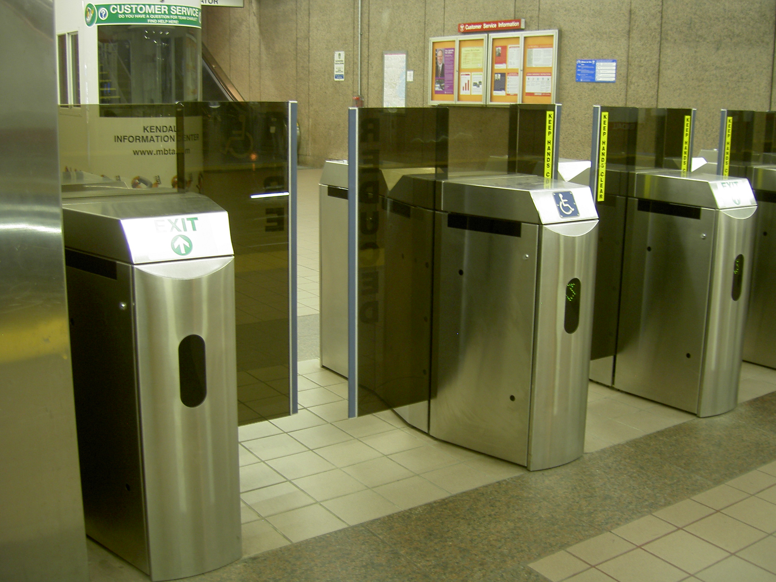
Fare gates at an MBTA station in Boston. (Dan4th Nicholas/Flickr)

As part of a new fare "control strategy", OC Transpo recommends the installation of fare barriers at Confederation Line and O-Train stations. In a report to be debated at the Transit Commission meeting next week, the implementation of fare-related equipment including fare gates, fare vending machines, and customer service communication posts, is estimated to cost between $20 and $25 million.

Physical fare barriers at O-Train stations, which are to be sheltered with "weather-protected enclosures", will be tested in 2016 before the Confederation Line opens. The decision between automated gates and turnstiles has not been made yet. The advantage to automated gates is that anyone can go through them including those who use wheelchairs or strollers.

In addition to acting as fare collectors, fare gates can be used for crowd control purposes like on Canada Day or during an emergency. The plan is to have them monitored and controlled by OC Transpo control centre. The remote ability to lock the gates is useful when there is an expected or unexpected service shutdown, for example. No one wants to pay their fare only to find out that train service isn't running.

With this method of fare collection, there is no need for POP (proof-of-payment) checkers on board any train. While it's not stated in the report, double-deckers and articulated buses will presumably continue to be inspected under the POP system.

Monday, October 28, 2013

Construction update: Downtown tunnel portals, Oct. 2013

Yesterday, I checked out the construction progress of the downtown tunnel portals. We've shown photos of the construction sites taken in July, and in early and late September, most of them of the western tunnel entrance. In this construction update, both portals are featured and they were photographed on October 27, 2013.

Western Portal


One of the project signs near the western portal faces Albert Street:


A look westwards from the tunnel entrance:


Eastern Portal

Some close-ups of the trench:


The view from the fifth and fourth floors of the University of Ottawa's Simard building:


I'll post more photos in an update once the roadheaders are put to work.

Wednesday, October 16, 2013

Stage 2 Details: Connaught Park Tunnel


Among the many interesting facets of the City of Ottawa's proposed Transportation Master Plan and its $2.5B worth of public transit projects (that "Stage 2" thing) is the acceleration of a light-rail extension to Bayshore Station. This is likely interesting to many in the city's west end, but particularly to me from a personal perspective since I live right near the proposed Connaught tunnel in the Queensway Terrace North community.

As some background: The proposed Connaught tunnel is nothing is nothing new. It was initially proposed back in 1994 (and approved in 1996) when the city was looking for a more efficient way of getting buses to Bayshore Station. Without room beside the Queensway, it seemed like cutting through the community north of the Queensway--appropriately known as Queensway Terrace North--like so:


In 2007, though, that plan was changed to the less costly (by an estimated $30M) option of expropriating 25 houses on the south side of Roman Avenue in order to run a Transitway parallel to the Queensway towards Pinecrest Station. This plan resulted in a huge campaign to "save Roman Avenue," and in 2011 the city reversed its prior decision and went back to the Connaught Park bus tunnel idea at an estimated cost of $138M.

As the map above indicates, the tunnel as proposed will branch off the Southwest Transitway north of the Queensway into NCC land, taking a bridge over Pinecrest Creek before descending into a tunnel under Connaught Park, Connaught Avenue, and the Queensview bus garage before coming to the surface around a brand new Queensview Station and then proceeding to Pinecrest Station and onto Bayshore.


Of course, there's an elephant in this room: This proposal will definitely require the support of the National Capital Commission, and will definitely impact the Pinecrest Creek corridor. We're all in for at least a few more years of discussions between the NCC and the City, with the Richmond Underground still awaiting approval from the NCC as well as this request. The City will also have to go through a complete environmental assessment (EA) process, since the EA that had been completed in 1996 was specifically for a bus tunnel.

The big development for this project in the Stage 2 plan (aside from the acceleration of the tunnel's construction) is the decision to bypass the BRT set-up and move straight to LRT. The extension from Lincoln Fields Station to Bayshore Station via the Connaught Park tunnel has been estimated at $400M, although it's unclear exactly how much of that is for the tunnel directly.


This spur to Bayshore is something that Kanata North councillor Marianne Wilkinson has been pushing for since January of 2011. It's a component of the plan that would hugely improve the transit experience for commuters from Kanata, allowing them to transfer to trains at Bayshore and continue on their trip much more quickly, in my estimation. With the huge renovations being done to Bayshore, it's becoming a major attraction, as well; connecting it to the main network is a sensible (if, at $400M, expensive) addition to the revised plan.

It's been clear for quite some time that the city needed a new way to connect Pinecrest and Bayshore to the main Transitway corridor; merging with the Queensway (as express buses and the 96 do) is unnecessarily complicated for riders and drivers, while the 97's route along Richmond Road and Carling Avenue can be exceptionally slow at times. The Connaught Tunnel is the city's chosen solution to the bottleneck right now, but it'll be interesting to see how the plan moves forward from here.

Tuesday, October 15, 2013

New bus on-ramp to 417 eastbound to open at Canadian Tire Centre

Bus riders leaving Canadian Tire Centre will finally have quicker access to the Queensway. Starting on Thursday after the Sens home-opener, the dedicated bus on-ramp to Highway 417 will be open, allowing the 400-series passengers to save about 15 minutes. Also on the same night, CTC will offer free parking, which will likely increase traffic and make the bus ramp an even greater benefit to transit users. When the project was first announced in July 2011, the idea was to give transit buses exiting the stop loop priority to the on-ramp first and to allow other HOV's access next.


Some people on Twitter complained about "Stage 2" of the proposed Transportation Master Plan draft, saying the western LRT extension should reach all the way to the Senators arena. There are a number of reasons for this to not happen. As mentioned earlier, the bus on-ramp was in the works for the past couple of years. The only real activity surrounding the rink occurs after large concerts and hockey games for about half an hour or so each night. And since there isn't much of anything nearby (employment, retail, residential spaces), a light-rail line serving the arena is unappealing for everyday use. Until the area becomes more than a place to watch hockey, the bus ramp will do just fine.

Friday, October 11, 2013

New-look Confederation Line website provides construction updates

OttawaLightRail.ca


The official Confederation Line website was re-designed recently and is now providing updates on the construction progress.

Here's their update for this week:

West Portal

  • Removal of blasted rock and grubbing continues.
  • Assembly of the first roadheader is completed.
  • Blasting to excavate the ramp is completed.
  • Excavation with hoe ram is scheduled to be completed by October 9.
Central Shaft

  • Excavation continues.
  • Installation of caissons continues for the foundation of the gantry crane
  • Blasting at the central shaft is scheduled to begin by end of the week.
 East Portal

  • Surface excavation of the construction ramp continues.
 Highway 417

  • Sewer and storm sewer work continues along the length of the highway.
  • Advanced Traffic Management System (ATMS) work, including temporary poles and aerial wires, continues along the highway.
  • Removals of retaining walls and bridge work continues along the highway.
 MSF

  • Demolition is scheduled to be completed by end of the week, with the exception of 737 Belfast Rd.
  • Grubbing and material removal off-site continues.

Thursday, October 10, 2013

Transit corridors that are no longer considered priorities

The newly proposed light-rail projects, named "Stage 2", in the 2013 Transportation Master Plan draft lead the transit discussion. To make room for these new initiatives, some project ideas in 2008 had to be dropped from the plan or moved beyond 2031. A comparison between the 2013 and 2008 maps will determine which transit corridors are no longer a priority.

Current 2013 proposed 2031 "affordable" transit network map:


From 2008, the 2031 transit network map:


(The links above open full-sized maps in PDF format.)

In Orleans, the Cumberland Transitway doesn't seem to be a priority anymore with the newly proposed Confederation Line extension into the eastern suburb. In 2008, the plan for Orleans was to have two busways, one grade separated along Regional Road 174 and one along Innes, both to Trim Road. Five years later, the new plan is to have light-rail extended from Blair to Place D'Orleans along Highway 174 and transit priority measurements (bus lanes, transit signal priority at intersections) on Innes Rd, Blackburn Bypass, and Brian Coburn Blvd.

The Innes Road/Industrial Avenue BRT, west of Orleans, from the 2008 plan is completely removed from this year's draft. The busway would have been parallel to the Confederation LRT Line, acting as a secondary east-west rapid transit corridor.

While the O-Train line is still planned to be extended to Bowesville, it will no longer reach Limebank as envisioned in 2008 and a rail link to the Ottawa International Airport has been removed too. Improved transit service to and from the airport is expected to happen by 2031 when HOV lanes are implemented on the Airport Parkway.

Heron/Walkley/Russell/St. Laurent was once a suggested route for bus lanes, but that's been removed from the current draft plan. St. Laurent Blvd will instead receive transit priority signals and queue jump lanes at some intersections.

Carling Avenue will no longer be a priority for rail of any kind and instead, bus lanes will be in place from the O-Train station to Lincoln Fields Station. There was a lot of discussion about Carling Avenue as an alternative route to the Sir John A. MacDonald Parkway for light rail. Or perhaps, the corridor would be served by a tram or streetcar of some sort with more local stops. For the next two decades though, it's strictly buses.

A Transitway linking Baseline Station to the Barrhaven Transitway will have to wait after 2031.

In Barrhaven, the Transitway was supposed to get an extension southwards eventually from Barrhaven Centre to Cambrian and another one eastwards along Chapman Mills across the Strandherd-Armstrong bridge, which isn't complete yet, to the previously proposed terminus of the O-Train line at Limebank Road. That was the idea five years ago and today, the plan is to have a combination of bus lanes and other transit priority measures on the same east-west route connecting Barrhaven with Riverside South.

The Kanata North Transitway will no longer be constructed northwards to Maxwell Bridge and instead, it will end at Carling Avenue. The Kanata Transitway, which was planned to run north along Highway 417 from Moodie to Huntmar and dip south between Stittsville and Kanata to Fernbank Road, is removed entirely from the 2013 plan. There are no transit priority measures of any kind in place of it.

Many transit initiatives planned to be implemented by 2031

On Wednesday morning, Mayor Watson announced the City of Ottawa’s proposed transit network plan which includes the eastern extension of the Confederation Line to Place D’Orleans, western extension to Bayshore, southern extension of the O-Train line to Bowesville, all at a cost of $2.5 billion and to be completed by 2023. 

Although there doesn't seem to be any timeline attached to each project, the costs of the proposed light-rail projects were revealed in the updated TMP draft (page 38 on document, 42 on Adobe Reader):

  • O-Train southern extension from Greenboro Station to Bowesville with new stations at Gladstone, Walkley, South Keys, Leitrim, and Bowesville: $99 million. No station or connection is planned at the Airport.
  • Western LRT extension of the Confederation Line from Tunney’s Pasture to Baseline Road along existing Transitway corridor: $980 million. This proposed project was already being discussed at city hall well before the updated TMP.
  • Western LRT extension from Lincoln Fields to Bayshore in a tunnel underneath Connaught Avenue: $396 million.
  • Eastern LRT extension of the Confederation Line from Blair Station to Place D’Orleans: $500 million.
These figures are in 2013 dollars. So, in a few years, the prices of these projects will probably increase with inflation.

Buried in the draft of the Transportation Master Plan are some non-LRT transit initiatives. Here are the "affordable" BRT ones that can be implemented by 2031: 
  • Western Transitway extension from Bayshore to west of Moodie Drive will run along Highway 417 with one station near Moodie Drive. This busway, from the original TMP of 2008, is priced at $79 million.
  • Bus-rapid transit (BRT) along Baseline Road from Heron to Baseline Stations. This is a new BRT line to be constructed on the existing road with at-grade intersections and is priced at $131 million.
  • A Kanata North at-grade BRT Transitway will follow March Road, connecting Highway 417 to Carling Avenue. Kanata’s first busway will cost $110 million. This western busway was also in the 2008 TMP.

According to the next page, the number of Airport Parkway lanes will double from two to four from Hunt Club to the MacDonald-Cartier International Airport. The new lanes will become HOV lanes, but buses can only use the lanes during peak periods. The expansion is scheduled for construction between 2026 and 2031, as per the appendix.

Further down the same page, the draft of the TMP also lists some roads that can potentially feature new bus lanes:

  • Carling Avenue from the Carling O-Train Station to Lincoln Fields Station. It’s currently being served by routes 6, 16, 85, 101, 102.
  • Hemlock Road & Codd’s Road from St. Laurent Boulevard to Montreal Road. There is currently no service on these sections of roads.
  • Hunt Club Road from Albion Road to Uplands Drive. It’s currently being served by routes 1, 87, 98, 114, 116, 143, 146, 147, 189, 199.
  • Montreal Road from St Laurent to Blair Road.  It’s currently being served by route 12. The hours of the existing priority lanes form Cummings Bridge to St Laurent Blvd are to be extended.
  • Blackburn Bypass peak period lanes.
 
Here are some streets that are supposed to have both queue jump lanes and transit signal priority at selected intersections in the future:
  • Baseline Road from Baseline Station to Bayshore Station, currently served by (The plan says “Bayshore” and there’s no existing bus route that connects Baseline Station to Bayshore.) It’s currently being served by route 118.
  • Carling Avenue from Bronson Avenue to Carling O-Train Station. It’s currently being served by routes 6, 85, 101, 102.
  • Chapman Mills / Strandherd / Earl Armstrong from Barrhaven Centre to proposed Bowesville O-Train Station. Chapman Mills and Strandherd are supposed to be served by routes 94, 95 once the Strandherd-Armstrong bridge is completed.
  • Eagleson Road from Hazeldean Road to Highway 417. It’s currently being served by routes 96, 61, 62, 164, 168.
  • Hazeldean Road from Stittsville Main Street to Eagleson Road. It’s currently being served by routes 96, 118.
  • Innes Road and Blair Road from Millennium Station to Blair Station. It’s currently being served by routes 94, 121. 126, 128, 131.
  • Jeanne D’Arc Boulevard from Innes Road to Jeanne D’Arc Station. It’s currently being served by routes 30/130, 31/131, 132.
  • March Road from Carling Avenue to Maxwell Bridge Road. It’s currently being served by route 60.
  • Merivale Road from Baseline Road to Carling Avenue. It’s currently being served by routes 14, 151, 176.
  • Orleans Boulevard from Jeanne D’Arc Boulevard South to proposed Orleans Blvd LRT Station. It’s currently being served by routes 34/134, 132.
  • Richmond Road / Wellington Street West / Somerset Street from Woodroffe Avenue to Bank Street. It’s currently being served by route 2.
  • Robertson Road and Richmond Road from Eagleson Road to Baseline Road. It’s currently being served by routes 118, 97.
  • St Laurent Boulevard from Innes Road to Montreal Road. It’s currently being served by routes 114, 5, 7, 14.
  • Tenth Line Road from Charlemagne Boulevard to Regional Road 174. It’s currently being served by route 136.

To be clear, these transit initiatives are considered to be "affordable" and can be implemented by 2031. BRT projects are supposed to cost $317 million, while the transit priority projects (bus lanes, transit signal priority, etc) are estimated at $200 million, bringing the total cost to just under $3 billion.

Wednesday, October 9, 2013

Proposed transportation plan features light rail extensions to be completed by 2023


Mayor Jim Watson announced the City of Ottawa's proposed Transportation Master Plan this morning, and the ambitious plan includes light-rail extensions to Baseline, Bayshore, and Place D'Orleans, plus conversion of the O-Train to light-rail before adding in new stations on the current line and then extending the whole thing to Bowesville -- all happening concurrently, all finished before 2023, at a price tag of about $2.5B.

Here are the details of the mayor's speech from various city hall reporters and the mayor himself:


Not sure what that entails. It could mean better bus service connecting to the Confederation Line, since the college is not considered within walking distance from either Cyrville or Blair Station.


The new busways in the west are nothing new. Kanata North will likely see more reliable and less travel times for route 93 once the busway opens.

These "new bus measures in the east along Blair" are probably for route 94. Innes was mentioned as one of the "transit priority" roads in the city's media release. The others are Montreal Road, Hunt Club Road, Carling Avenue, and Bank Street. Transit priority usually means an adjustment of the traffic lights to minimize delays to transit vehicles.


The Airport Parkway will be expanded to four lanes total. The HOV lane will certainly improve service on the 97 route. Creating dedicated lanes act as an alternative to extending the O-Train to the airport. (As you'll see later, the O-Train line extends south of the airport, but doesn't connect to it.)


This benefits transit users in that area too because they'll now have access to either routes 16 or 18.


Plenty of discussion about the Richmond Underground already.


One of the proposed light-rail extensions is from Lincoln Fields to Bayshore Shopping Centre and here's how it's supposed to look:

So, it appears the Pinecrest-Bayshore busway, where routes 93 and 96 travel, will be converted into light-rail.


The O-Train south extension:
Interesting how there's an LRT extension to a rural area, but not to the airport. The additional ridership from the added stations and line extension can't be supported from the existing single track sections of the line. It would have to be expanded entirely to double-tracking eventually.

The new stations in the south will take some pressure off buses on the south-east Transitway, which is likely the goal here. To the north, the Gladstone O-Train station is a welcome addition.


Orleans LRT extension:

Most of the 95 bus line will be replaced in the east end and Orleans Boulevard Station will be a new station since there isn't an existing BRT one at the moment. One thing to note is the rail line will extend through the Greenbelt on NCC land, which is not something the crown corporation will easily give up.


This is supposed to be one large project, both physically and financially:


Hard to imagine all rail extensions would be constructed simultaneously within ten years, given that both federal and provincial governments are experiencing enormous budget deficits.


The new bold LRT plan is called "Stage 2":


The draft outline of the Transportation Master Plan can be seen on the city's website and further details are to be released later this afternoon by the city. The plan will be debated at a Transit Commission meeting next week, and at a Transportation Commission and City Council meetings in November.

Friday, October 4, 2013

uOttawa wanted its name on Lees LRT Station

If the University of Ottawa had its way, we would see "uOttawa - Canal" and "uOttawa - Lees" signs at LRT stations. According to the Citizen, the downtown university wanted both uOttawa and Lees LRT Stations to be named after the school.

The similar names can be confusing for new transit users and first-year Ottawa U students. Besides the school having an issue, there weren't any publicly known concerns raised with the name "Lees". The problem with naming it "uOttawa - Lees" is that Lees Ottawa U campus isn't the only destination the Confederation Line will serve. Existing high-rise apartments are in close proximity to the station and the city wants to intensify the surrounding area. Taking on the university's proposed name conflicts with the city's transit-oriented development goals, especially when the name of the school comes first.